
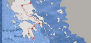
> List of the cultural trail stations Thessaloniki - Mystras: "Constantine XI Palaiologos"
Thessaloniki
 Around the top of the Thermaic Gulf there were several small ancient towns with intense commercial activity, which further expanded after the destruction of Olynthus by Philip in 348 BC. According to Strabo, King Cassander founded a new city in 316 BC, naming it Thessaloniki after his wife, sister to Alexander the Great. The few traces of Hellenistic buildings identified to date - an important administrative building complex in Governing House Square, and the east part of the wall - indicate that from the outset the city was intended to be a major political and military centre. Thessaloniki’s geographic location at a key point on Macedonia’s land and sea routes was an important factor in its growth down the centuries. More
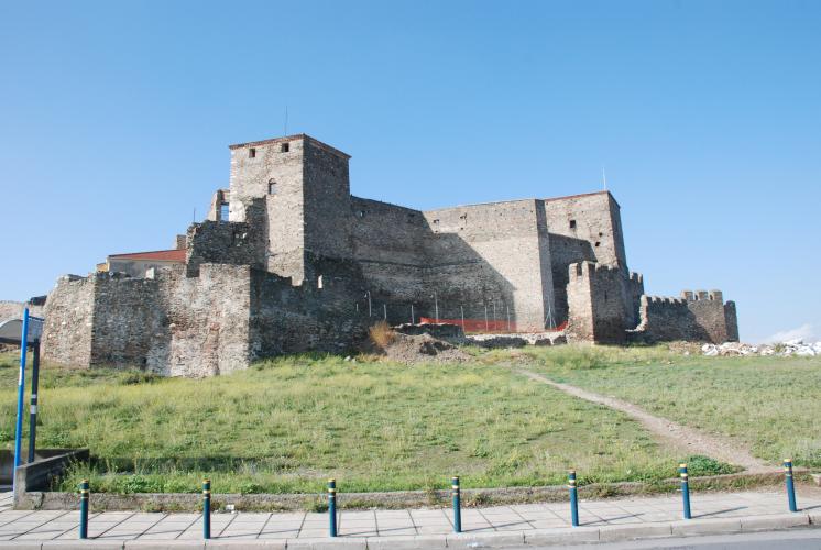
Platamonas
 Platamonas is located by the sea, on a hill at the southeast foot of Mount Olympus. A city-fortress, it was founded during the mid-Byzantine period near the ancient city of Heraklion. The name Platamon is first attested in a chrysobull issued by Alexius III in 1198, granting the Venetians visiting privileges to the city. During the rule of the Franks, from 1204 to 1224, the castle came under the supervision of Rolando Piscia or Pise, who seems to have carried out repair works and lent the castle its present form. Platamonas then came under the rule of Theodore Comnenus Ducas, while in the 14th century it was used in wars waged by Catacuzenus and Apocaucus, then being referred to as a “small town” or “village”. Due to its important strategic position, the castle of Platamon remained in use even after its capture by the Turks, and was repaired and rebuilt many times during the Ottoman period; in 1897, heavy bombardment by the Greek naval commander Sachtouris forced the Turks to abandon the castle. It remained desolate until the Second World War, when the hill was reused as a fortified position. More
Meteora
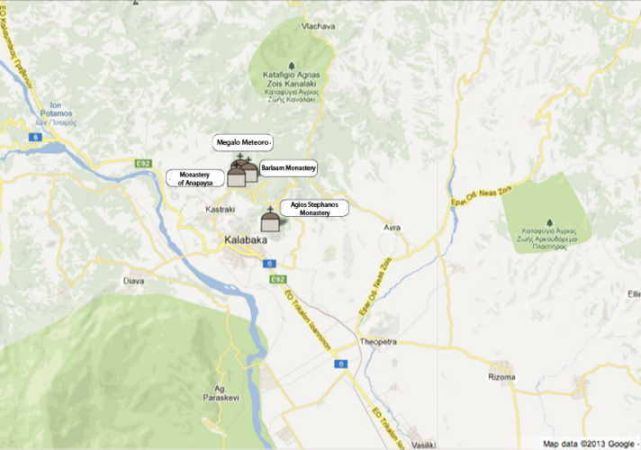 Located in the northwest of the Thessalian Plain, in the prefecture of Trikala, Meteora is a highly striking group of monuments. With their architecture, painted decoration and relics, the monasteries perfectly complement the complex and unique geological rock formations in the area, some of which exceed 400 metres in height.
Six major monasteries are open to visitors; other smaller abandoned, hermitages, countless wall paintings, hundreds of relics in the form of icons, manuscripts, books, silver liturgical vessels, holy vestments, articles of daily use and tributes all make Meteora the second largest monastic complex in Greece after Mount Athos. More
Located in the northwest of the Thessalian Plain, in the prefecture of Trikala, Meteora is a highly striking group of monuments. With their architecture, painted decoration and relics, the monasteries perfectly complement the complex and unique geological rock formations in the area, some of which exceed 400 metres in height.
Six major monasteries are open to visitors; other smaller abandoned, hermitages, countless wall paintings, hundreds of relics in the form of icons, manuscripts, books, silver liturgical vessels, holy vestments, articles of daily use and tributes all make Meteora the second largest monastic complex in Greece after Mount Athos. More
Athens
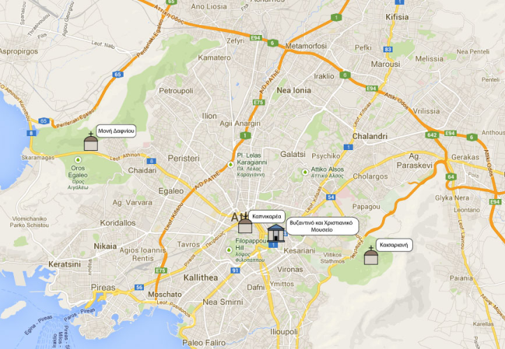 In the 1st and 2nd century Athens was a wealthy city and one of the empire’s major intellectual centres, which frequently attracted the attention and patronage of emperors and wealthy civilians. Hadrian increased the perimeter of the walls and almost doubled the city’s area. Herod Atticus adorned it with groups of monuments that have survived in part to this day. That being said, serious damage was done when the one-time glorious city was taken by the Heruli in 267, and raided by the Goths under Alaric in 396. The Acropolis, the Roman agora and Hadrian’s Library were surrounded by a wall, which became Athens’ main fortification. Plato’s Academy was revitalized from the early 4th to the early 6th century by the neo-platonic philosophers, who taught rhetoric and philosophy to promising Christian and pagan youths from all over the empire; three of its students were Basil the Great, Gregory of Nazianzus and Emperor Julian. Empress Pulcheria was so impressed by the education received by Athinaïs, daughter of the sophist Leontius, that in 421 she had her forcibly christened Eudocia and wed her to her brother, Emperor Theodosius II. The so-called Palace of Giants, founded in the ancient agora in this period, may have belonged to Eudocia and her family. More
Corinth
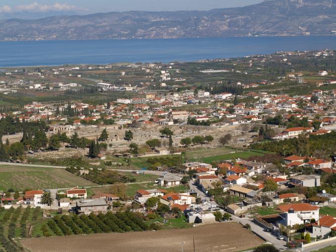 Corinth remained a thriving city in Late Antiquity, on account of its strategic location and the commercial activity in its two seaports, Kechrees and Lechaion. Earthquakes in 365 and 375 dealt the city a serious blow, as did Gothic raids in 395/6. City space was confined within the newly built Late Roman or Early Byzantine walls, parts of which still survive in places in the village of Ancient Corinth. Though previously linked by walls to Acrocorinth, the city now lost this connection. The significance of the ancient forum seems to have diminished, and archaeological evidence points to the domestic activities and small industries of a poor neighbourhood. More
Nafplion
 Legend has it that the city of Nafplio was founded by Nauplius, son of Poseidon and Amymone, daughter of King Danaus of Argos. His son was the hero Palamedes, who gave his name to the high rocky mound to the southeast. The city was founded on a small peninsula 85m high, 900m long and roughly 400m wide. In modern times it was named Akronafplia in replacement of its Turkish name (Iç Kale). It was accessible only from the north, via the neck of Arvanitia, a spit of land created by silting. From the start, the city served as the port of Argos and always lay in its shadow and under its influence. More
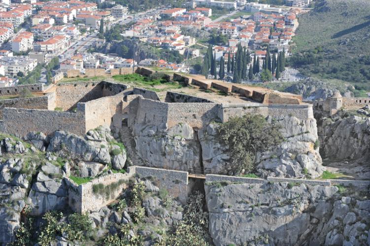
Monembasia
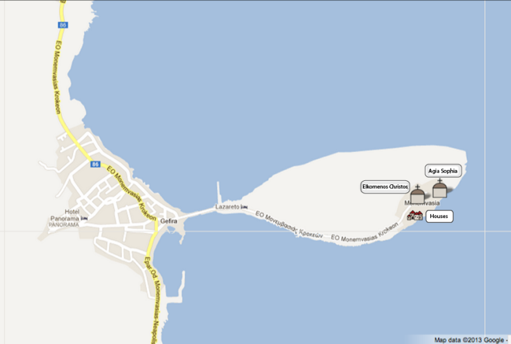 Urban development in the Upper and Lower City of Monemvasia was determined by the terrain and the area available for building.
Upper City houses typically stand two or three storeys tall, are larger than those in the Lower City and are built parallel to each other. Between them are pathways that may have replaced earlier cobbled roads. These houses belonged to the local aristocracy, to state and military officials, as well as to the city’s rulers. Only one of the buildings in the Upper City seems to have been public; it is an impressive structure measuring at least 25 x 25m - possibly the local commander’s headquarters - on the south-western side of the plateau. It has cisterns and vaulted spaces on two levels, an open plan wooden roofed triclinium on the upper floor and a balcony (solar) facing the sea. More
Urban development in the Upper and Lower City of Monemvasia was determined by the terrain and the area available for building.
Upper City houses typically stand two or three storeys tall, are larger than those in the Lower City and are built parallel to each other. Between them are pathways that may have replaced earlier cobbled roads. These houses belonged to the local aristocracy, to state and military officials, as well as to the city’s rulers. Only one of the buildings in the Upper City seems to have been public; it is an impressive structure measuring at least 25 x 25m - possibly the local commander’s headquarters - on the south-western side of the plateau. It has cisterns and vaulted spaces on two levels, an open plan wooden roofed triclinium on the upper floor and a balcony (solar) facing the sea. More
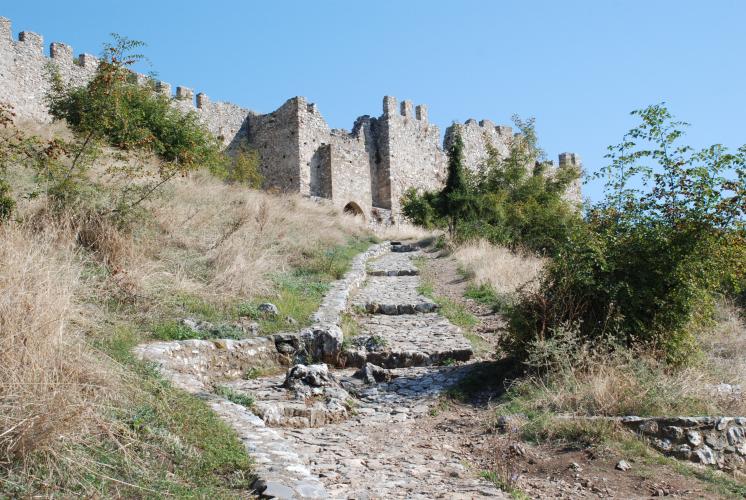
Mystras
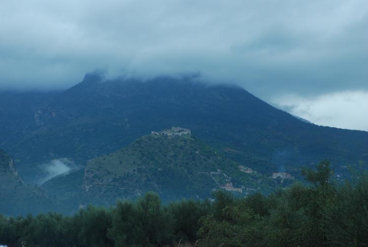 The castle of Mystras or Myzithra was founded in 1249 by the Frankish Prince William II de Villehardouin. It lies on the top of a mound in the foothills of Mt. Taygetus, a few miles to the north-west of Lacedaemon, as Sparta was known in the Byzantine era. The hill is naturally fortified; it is completely inaccessible from the south and southeast, as the rock rises almost vertically to an incredible height. However, the view of the Eurotas river valley is not blocked by anything to the north, east and south - the site is crucial to controlling the area. The name Mystras is probably derived from some landowner in the area whose surname or profession was Myzithras (a cheese maker). More